

Deformation bands are observed in rock core from the Volve Field. The field is a fault block structure with about 173 million barrels of oil in place [1] and is located in the Nortwegian Sector of the Central North Sea, just to the East of Sleipner West (Fig 1).

Fig 1. Location of Volve Field (Google maps)
What do we see on the cored sandstone photos ?
The images in fig 2. are from a subsurface/production database made available by Equinor in c. 2018 [1, 2]. Note how the sandstone in fig. 2 (left hand side) is oil stained but the white coloured deformation bands are not. This indicates that they are a barrier/seal to hydrocarbon likely as a result of the reduced grain sizes (relative to the host rock) resulting in a reduced porosity and permeability (Fig. 3). Also, note that these are fairly thick (10 mm) putting more weight on a “seal”.
Are these structures laterally extensive seals/barriers ?
The deformation bands on the right hand image are darker and may be oil stained. An explanation from the discovery report [1] is that the lighter bands do seal but the sealing property has limited lateral extent and the significant oil column has broken the seal of the thinner darker bands. Another explanation is that these dark bands they are enriched in clay minerals (phyllosilicate framework fault rocks).
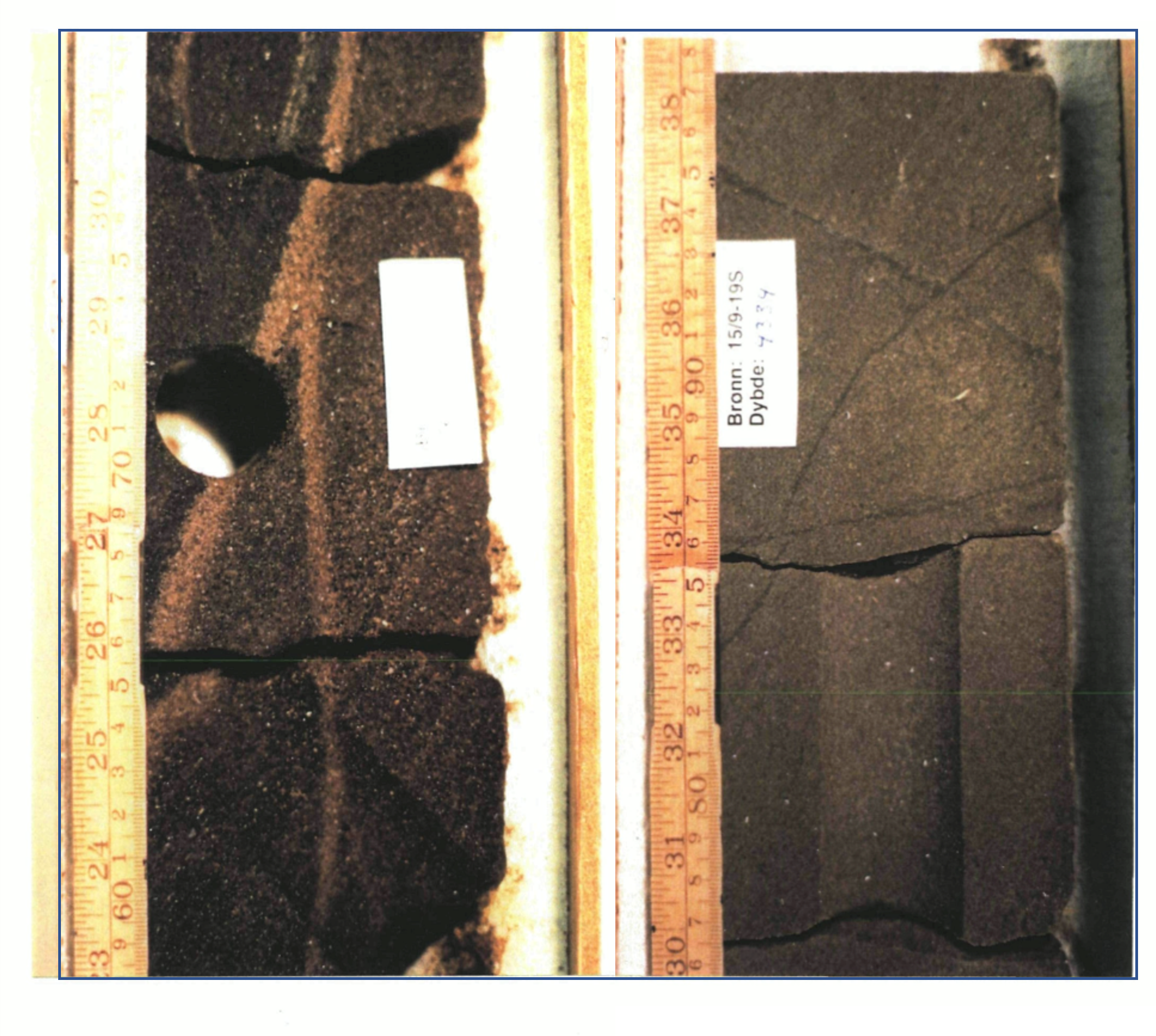
Fig. 2. Deformation bands in the Jurassic Sandstones (Hugin Fm) of the Volve Field, North Sea. Well 15/9-19. Left: white coloured deformation bands in oil stained coarse sandstones. Right: stained deformation bands may indicate invasion of oil.

Fig. 3. Thin section photo of a thin section taken across one of the light coloured deformation bands in Fig. 2. 100x magnification. Note the grain crushing and por/perm reduction. There may be some enhanced grain contact quartz dissolution although clays appear to coat the grains.
And clay smears…. ?
There are more obvious clay type structures in the same well (Fig. 4) in the Triassic Skagerrak Fm. The associated report (from the public dataset) indicates these are clay smears but inspection of the core would be needed to validate this.

Fig. 4. Clay smear from the Volve Field, Triassic section. The asspciated report [1] questions if these structures are synsedimentary due to associated folding.
[1] Equinor. Volve Field Dataset. Available online: https://data.equinor.com/dataset/Volve
[2] Wang, B, Sarma, J, Chen, J, Persaud, P. 2021. Ensemble Machine Learning Assisted Reservoir Characterization Using Field Production Data–An Offshore Field Case Study. Energies 2021, 14 (4), 1052.