
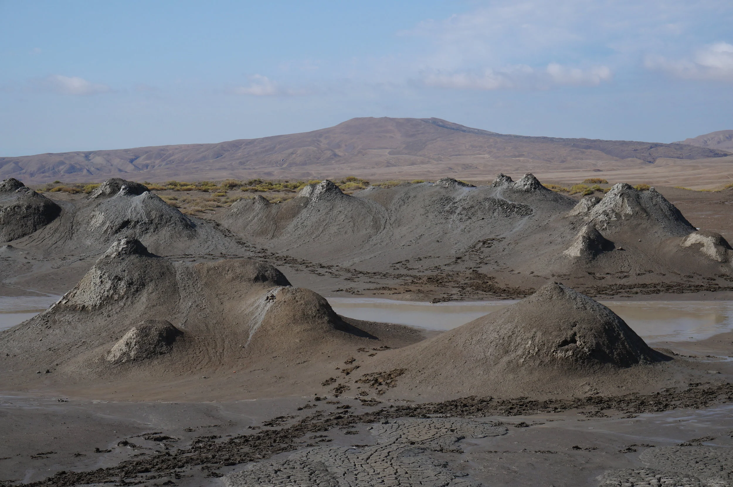
Mud Volcanoes are much smaller than normal volcanoes and according to Wikipedia, about half of those known to exist are found in coastal Azerbaijan (Figure 1). You can walk right up to the mud volcanoes and see the mud bubbling in the crater (Figures 2, 3). The mud is linked to the deep underlying Maykop Shale which is the source rock for offshore (Caspian) reservoirs.

Figure 1. Mud Volcanoes at Gobustan, coastal Azerbaijan.


Figure 2. (a) Mud volcano about 1 mETRE high with (b) gas bubbling in the CRATER.
The mud flows can form lobes downslope. When they dry out, desiccation cracks form (Figure 3).

Figure 3. Lobe shaped mud flows with desiccation cracks showing where the mud has dried out.
They are formed by tectonic processes such as the build up of overpressure in compressive settings or by maturation and degassing of rapidly buried organic rich sediments (Planke et al. 2003). On-going rapid sedimentation loads the flanks of anticlines. The shale then rises due to buoyancy to the centre of the anticline (through multiple pipes), and will form a mud volcano close to the sea bed (Figure 4).

Figure 4. Genesis of mud volcanoes. Yellow layers are reservoirs and the grey is the source rock shale which rises through pipes to the surface, forming a cone.
Despite creating spectacular geology, mud volcanoes are potential shallow hazards creating drilling problems offshore - i.e., a potential hinderance to reaching the deeper reservoir targets. Added complexity comes from associated radial and concentric patterns of faults (Figures 5, 6).

Figure 5. Seismic coherency cube looking down on a Mud Volcano cone in the Apsheron Anticline, SOUTH Caspian Sea. Concentric and some radial faults can be seen by the low coherency orange areas within the grey (coherent) host rock.
Source: Virtual Seismic Atlas, (Author Richard Davies). http://www.seismicatlas.org/entity?id=165e9535-7616-4f65-a991-30ee698d2a2f

Figure 6. (a) Section through a Mud Volcano in South Caspian Basin (b) Interpretation. Depositional units 1 – 4. Concentric normal faults (T), downward tapering cone (U); top of the mud volcano surface (TMV); note onlapping sediments at sides. Base of the mud volcano surface (BMV); base of the overburden surface (BOS).
Source Virtual Seismic Atlas. http://www.seismicatlas.org/entity?id=b1cd4cf6-41ed-4f69-8189-edc8cc08e865
Reference
Planke, S, Svenen, H, Hovland, M, Banks, D, A, Jamtveit, B. 2003. Mud and Fluid Migration in Active Mud Volcanoes, in Azerbaijan. Geoscience Marine Letters 23, 258 - 268.