BackgroundHere we present an integrated characterisation of a fault zone in mudstones (from the Valhall Field, Central N Sea) using log and core data from a single well. The data was collected to estimate the petrophysical properties of the mudstone - a few years after drilling the well, more advanced formation evaluation data and core was evaluated for fault characterisation
Observations madeThe following observations were made at a similar depth are interpreted as a fault or fault zone.
Fast shear azimuth - (on right hand most track in Fig. 1) is a useful proxy for the direction of Shmax. Across this logged section it is consistently NW-SE apart from at the red hooped interval in Fig. 1. This suggests a perturbation in the anisotropy orientations and magnitudes - which can also be seen as a change in the character of the calliper curve (track 1).
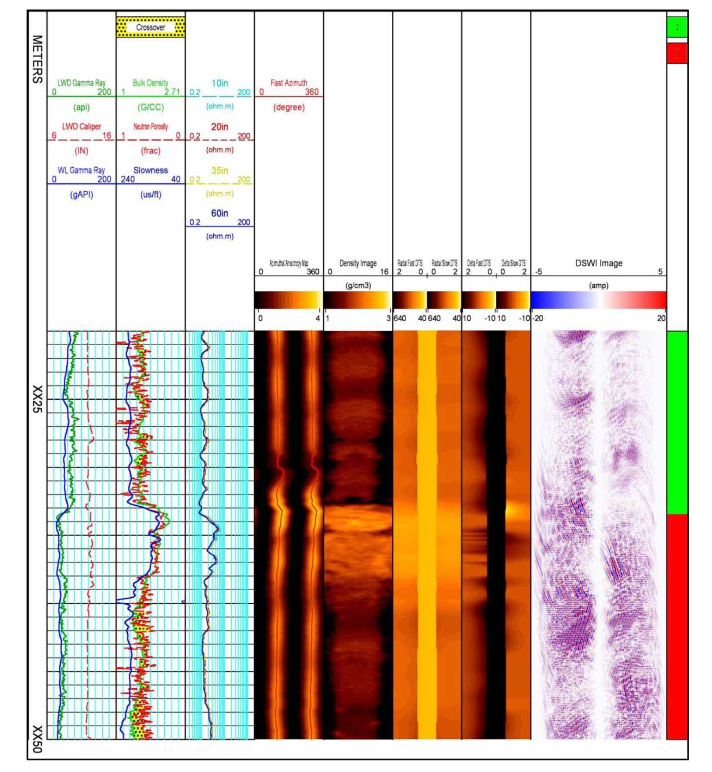
Density log (track 6, fig. 2) - with resolution enhancement - shows a zone of bedding disturbance at approx. same depth interval as above.
Shear slowness vs. distance from borehole (track 7, fig. 2 with borehole in centre and track edges represents 2 ft from borehole axis - right hand image is variation in slow shear whereas left hand image is fast shear) - note the change at approx same interval as the logs above.
Near wellbore reflection image (track 9 fig. 2) - picking up reflections from planar features in the formation - note the stronger reflections at the interval of interest from the above logs.
Rubble zone (fig. 3) consisting of pods of mudstones that were originally surrounded by black hairline fractures - the pods were dislodged during coring.
Fig. 1. Azimuthal anisotropy from Sonic LWD data
Fig. 2. Integration of log data showing location of fault.
Fig. 3 Photo of mudstone core from a rubble zone
Full article…
Bradley et al (2019). Overcoming coring challenges in a New Unconventional Play Offshore by Integration of Formation Evaluation Data. SPE paper presented at the SPE Annual Technical Conference and Exhibition held in Calgary, Alberta, Canada, 30 Sept - 2 Oct, 2019.


